Seit der MOBAC - Version 1.9.2 besteht die Möglichkeit eigene Kartenquellen hinzuzufügen und zu kombinieren.
Derzeit gibt es leider keine wirklich gute Sammlung... daher dieser Thread.
Vorgehensweise wie Folgt:
Im MOBAC unterordner /mapsources/ eine neue *.txt - Datei anlegen.
Inhalt reinkopieren und Speichern
*.txt in *.xml umbenennen
Fertig
MOBAC (ab 1.9.2) Cusom Map Sammlung als XML
MOBAC (ab 1.9.2) Cusom Map Sammlung als XML
Last edited by Gali+Leo on Fri Jan 06, 2012 4:26 pm, edited 1 time in total.

Re: MOBAC (ab 1.9.2) Cusom Map Sammlung als XML
OSM + Wanderwege + Höhendaten:
<?xml version="1.0" encoding="UTF-8" standalone="yes"?>
<customMultiLayerMapSource>
<name>OSM Lonvia Mapnik</name>
<tileType>PNG</tileType>
<layers>
<customMapSource>
<name>Mapnik</name>
<minZoom>5</minZoom>
<maxZoom>16</maxZoom>
<tileType>PNG</tileType>
<tileUpdate>None</tileUpdate>
<url>http://c.tile.openstreetmap.org/{$z}/{$x}/{$y}.png</url>
<backgroundColor>#00000000</backgroundColor>
<ignoreErrors>true</ignoreErrors>
</customMapSource>
<customMapSource>
<name>OSM Lonvia Wanderwege</name>
<minZoom>5</minZoom>
<maxZoom>16</maxZoom>
<tileType>PNG</tileType>
<tileUpdate>Etag</tileUpdate>
<url>http://tile.lonvia.de/hiking/{$z}/{$x}/{$y}.png</url>
<ignoreErrors>true</ignoreErrors>
<backgroundColor>#00000000</backgroundColor>
</customMapSource>
<customMapSource>
<name>HikebikemapRelief</name>
<minZoom>8</minZoom>
<maxZoom>15</maxZoom>
<tileType>PNG</tileType>
<tileUpdate>None</tileUpdate>
<url>http://toolserver.org/~cmarqu/hill/{$z} ... }.png</url>
<backgroundColor>#00000000</backgroundColor>
</customMapSource>
</layers>
</customMultiLayerMapSource>
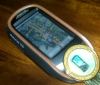
- Attachments
-
- sshot-2.jpg (79.96 KiB) Viewed 51278 times
Last edited by Gali+Leo on Fri Jan 06, 2012 4:29 pm, edited 2 times in total.
Re: MOBAC (ab 1.9.2) Cusom Map Sammlung als XML
Hier ist noch Google.... bei manchen MOBAC - Versionen nicht vorhanden. => Einfach in den Ordner /mapsources/ entpacken
- Attachments
-
- mp-google.zip
- (9.36 KiB) Downloaded 2759 times
Re: MOBAC (ab 1.9.2) Cusom Map Sammlung als XML
Google Maps + Höhendaten (Wem der Googel Terrain Modus nicht gefällt  )
)
<?xml version="1.0" encoding="UTF-8" standalone="yes"?>
<customMultiLayerMapSource>
<name>Google Maps + Hoehe</name>
<tileType>PNG</tileType>
<layers>
<customMapSource>
<name>Google Maps die zweite</name>
<minZoom>0</minZoom>
<maxZoom>19</maxZoom>
<tileType>png</tileType>
<tileUpdate>None</tileUpdate>
<url>http://mt0.google.com/vt/lyrs=m@1560000 ... ={$z}</url>
<backgroundColor>#000000</backgroundColor>
</customMapSource>
<customMapSource>
<name>HikebikemapRelief</name>
<minZoom>8</minZoom>
<maxZoom>16</maxZoom>
<tileType>PNG</tileType>
<tileUpdate>None</tileUpdate>
<url>http://toolserver.org/~cmarqu/hill/{$z} ... }.png</url>
<backgroundColor>#00000000</backgroundColor>
</customMapSource>
</layers>
</customMultiLayerMapSource>
- Attachments
-
- sshot-1.jpg (37.46 KiB) Viewed 51277 times
Re: MOBAC (ab 1.9.2) Cusom Map Sammlung als XML
OSM + Höhenlinien
<?xml version="1.0" encoding="UTF-8" standalone="yes"?>
<customMultiLayerMapSource>
<name>OSM + Hoehenlinien</name>
<tileType>PNG</tileType>
<layers>
<customMapSource>
<name>Mapnik</name>
<minZoom>5</minZoom>
<maxZoom>16</maxZoom>
<tileType>PNG</tileType>
<tileUpdate>None</tileUpdate>
<url>http://c.tile.openstreetmap.org/{$z}/{$x}/{$y}.png</url>
<backgroundColor>#00000000</backgroundColor>
<ignoreErrors>true</ignoreErrors>
</customMapSource>
<customMapSource>
<name>HikebikemapReliefhoehe</name>
<minZoom>0</minZoom>
<maxZoom>15</maxZoom>
<tileType>PNG</tileType>
<tileUpdate>None</tileUpdate>
<url>http://www.wanderreitkarte.de/hills/{$z ... }.png</url>
<backgroundColor>#00000000</backgroundColor>
</customMapSource>
</layers>
</customMultiLayerMapSource>
- Attachments
-
- 2012-01-10_194406-osm.jpg (200.32 KiB) Viewed 51225 times
Re: MOBAC (ab 1.9.2) Cusom Map Sammlung als XML
Google + Höhenlinien
<?xml version="1.0" encoding="UTF-8" standalone="yes"?>
<customMultiLayerMapSource>
<name>Google Maps + Hoehenlinien</name>
<tileType>PNG</tileType>
<layers>
<customMapSource>
<name>Google Maps die zweite</name>
<minZoom>0</minZoom>
<maxZoom>19</maxZoom>
<tileType>png</tileType>
<tileUpdate>None</tileUpdate>
<url>http://mt0.google.com/vt/lyrs=m@1560000 ... ={$z}</url>
<backgroundColor>#000000</backgroundColor>
</customMapSource>
<customMapSource>
<name>HikebikemapReliefhoehe</name>
<minZoom>0</minZoom>
<maxZoom>15</maxZoom>
<tileType>PNG</tileType>
<tileUpdate>None</tileUpdate>
<url>http://www.wanderreitkarte.de/hills/{$z ... }.png</url>
<backgroundColor>#00000000</backgroundColor>
</customMapSource>
</layers>
</customMultiLayerMapSource>
- Attachments
-
- 2012-01-10_194134.jpg (137.7 KiB) Viewed 51226 times
Re: MOBAC (ab 1.9.2) Cusom Map Sammlung als XML
Hallo Gali+Leo,
sieht ja cool aus, werde ich bestimmt mal ausprobieren.
Vielen Dank,
Caotix
sieht ja cool aus, werde ich bestimmt mal ausprobieren.
Vielen Dank,
Caotix
Re: MOBAC (ab 1.9.2) Cusom Map Sammlung als XML
Die Anleitung ist super - danke.
Allerdings finde ich auf meinem Mobac (1-8) keinen Unterordner "mapsources", in welchen ich ein script hineinkopieren könnte.
Allerdings finde ich auf meinem Mobac (1-8) keinen Unterordner "mapsources", in welchen ich ein script hineinkopieren könnte.
Re: MOBAC (ab 1.9.2) Cusom Map Sammlung als XML
In dieser Version müsstest Du doch die Karten direkt als Quelle auswählen können...
__̴ı̴̴̡̡̡ ̡͌l̡̡̡ ̡͌l̡*̡̡ ̴̡ı̴̴̡ ̡̡͡|̲̲̲͡͡͡ ̲▫̲͡ ̲̲̲͡͡π̲̲͡͡ ̲̲͡▫̲̲͡͡ ̲|̡̡̡ ̡ ̴̡ı̴̡̡ ̡͌l̡̡̡̡._
ColorTrak, Triton400 Carbon Edition, eXplorist110, eXploristGC, eXploristTouch, eXplorist710
ColorTrak, Triton400 Carbon Edition, eXplorist110, eXploristGC, eXploristTouch, eXplorist710
Re: MOBAC (ab 1.9.2) Cusom Map Sammlung als XML
Als Hilfestellung habe ich mal die letzte "vollwertige" Version von MobAC hochgeladen.
Mobile Atlas Creator 1.9 Preview 7 (kann auch Rmap für Twonav generieren)
http://depositfiles.com/files/d20dxhx5i
Mobile Atlas Creator 1.9 Preview 7 (kann auch Rmap für Twonav generieren)
http://depositfiles.com/files/d20dxhx5i
Viele Gruesse
Alois
Alois
-
karsten264
- Navigator
- Posts: 3
- Joined: Sat Jul 14, 2012 2:27 pm
Re: MOBAC (ab 1.9.2) Cusom Map Sammlung als XML
Hallo,
ich habe dieses interessante Thema gefunden und habe eine Frage.
Wie kann ich denn GMaps per XML Datei mit Optionen in MAC einbinden?
Ich möchte ganz gern eine Karte ohne Labels und Strassen erstellen.
Vielen Dank für jede Hilfe.
Gruß
Karsten
ich habe dieses interessante Thema gefunden und habe eine Frage.
Wie kann ich denn GMaps per XML Datei mit Optionen in MAC einbinden?
Ich möchte ganz gern eine Karte ohne Labels und Strassen erstellen.
Vielen Dank für jede Hilfe.
Gruß
Karsten
-
karsten264
- Navigator
- Posts: 3
- Joined: Sat Jul 14, 2012 2:27 pm
Re: MOBAC (ab 1.9.2) Cusom Map Sammlung als XML
Hat keiner einer Idee wie man das machen könnte?
Gruß
Karsten
Gruß
Karsten
Re: MOBAC (ab 1.9.2) Cusom Map Sammlung als XML
Hi sorry für die späte Antwort...
Gruß,
Haiko
Was verstehst Du darunter? Grundsätzlich kannst Du alles Was Du in Google siehst in MOBAC einbinden. Allerdings immer nur in der Form wie Google es zur Verfügung stellt. Bzw. eine andere API es zur Verfügung stellt. Hast Du eine Beispielseite mit den Daten die Du verwenden möchtest?karsten264 wrote:Ich möchte ganz gern eine Karte ohne Labels und Strassen erstellen.
Gruß,
Haiko
-
jakobheinrich
- Navigator
- Posts: 1
- Joined: Fri Sep 21, 2012 4:29 pm
Re: MOBAC (ab 1.9.2) Cusom Map Sammlung als XML
Hallo
eine neue Frage: Ich würde gerne open cycle map mit google earth verbinden. (nur kleine gebiete für wanderungen)
Nun habe ich schon die open cycle map hinzugefügt und dank gali+leo auch google erath, nur dass sie automatisch zusammen gefügt werden klappt noch nicht. (ich habe versucht die vorlagen von oben zu nehmen, aber mir fehlt die .xml für google earth)
Jemand eine Idee?
Schon mal danke
Jakob
- Attachments
-
- So soll es im Endeffekt aussehen
- cycle 14_0_0 (Kopie).jpeg (32.94 KiB) Viewed 48972 times
Re: MOBAC (ab 1.9.2) Cusom Map Sammlung als XML
Hier der xml-Inhalt von Google - Sat
Wenn Du es fertig hast, dann poste die xml doch hier....
Gruß,
Haiko
Code: Select all
<?xml version="1.0" encoding="UTF-8"?>
<customMapSource>
	<name>GoogleSat</name>
	<minZoom>0</minZoom>
	<maxZoom>19</maxZoom>
	<tileType>png</tileType>
	<tileUpdate>None</tileUpdate>
        <url>http://khm0.google.com/kh/v=117&x={$x}&y={$y}&z={$z}</url>
	<backgroundColor>#000000</backgroundColor>
</customMapSource>Gruß,
Haiko